\f
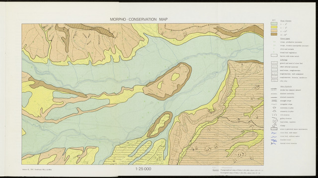
MORPHO - CONSERVATION MAP
mm
1:25 000
T~
Slope Classes
0 - 2°
2 - 5°
5 - 15°
15 - 30°
Cover types
crops, productive (cereals)
crops, erosion susceptible (cereals)
olive and cereals
broad leaf Vegetation
barren with some scrub
Lithology
gravel and sand of river bed
other alluvial material
sand stone, conglomerate
conglomerate, well cemented
conglomerate, breccia, sandstone
silty clay
Other Symbols
divide line (major; minor)
distinct convexity
distinct concavity
straight slope
irregulär slope
convexity in plan
concavity in plan
rill erosion
gulley erosion
land slide, inactive
slump
area oi potential mass movements
river bed, with water
river bed, without water
braided river
lateral river erosion
Annex II, ITC Textbook VII. 2 (196»)
Sources Topographical map of Italy 1:25,000; sheot 229-1V i:
Geological map of Italy 1:25,000; sheet 229-IV NE